Software
When you start working on your brand new itinerary,
lot of the geography, distances, roads, Park's entrances will
be almost unknown for you. Specially in this phase a mapping software
is extremely useful to study your trip's legs, to optimize the
order of your stops and much more. Once you itinerary is ready
you can use these softwares to manage all details, check where
your hotels are, where gas stations can be found, you can print
towns maps and, with some particular software, you can even plan
your outdoor activity. Nevertheless, after long "studies"
and and many simulations, in our specific case we didn't print
any map. On the road we preferred an old traditional road atlas.
Keep in mind that some of these softwares can't be sent ouside
the USA and if you live abroad you must either ask a friend or
wait till you're in the States and buy one for your next trip.
| Software
|
| |
|
| |
|
|
|
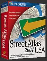
DeLorme Street
Atlas 2004 is surely one of the two
best mapping softwares to plan an on the road. Both CDs
in the package can be fully installed on your HD and take
about 1.13 GB.
This software is very precise and detailed. For example,
I was able to find any single restaurant, motel and gas
station where I had been in Moab, a little town in Utah.
If you've to choose your first software, probably DeLorme
Street Atlas is your best option.
|
|
 The
5.0 version has just been released The
5.0 version has just been released |
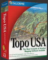
DeLorme Topo
USA 4.0 is a great a software. You
can use it either to plan a itinerary and, specially,
to plan your outdoor activity. The best part of this software
is surely its 3D view. It's great to have an idea of all
trail's characteristics, as the elevation gain, lenght,
height, profile...
More, you can even trace your own new trail and add it
to the already big collection of famous trails included
in the software's library.
Naturally this software requires pretty fast computers
and lot of space on your HD. In the package you'll find
7 CDs: a installation CD plus 6 other CDs each covering
a specifical area of the States. The good news is that
you can istall only the CD you're interested in. Each
one takes about 600 MB of HD space.
|
| Topo
USA 4.0 |
| by:
DeLorme |
| Price:
99.95$ |
| Official
Site |
| |
 |
| |
Microsof Streets
& Trips was my first
software when I planned my 2003 on the road. I worked on
the 2003 version but the new 2004 doesn't differ much. The
software comes on two CDs which can both be installed on
your HD taking about 970 MB. Streets&Trips is functional
an very well done. On some particular situations is a bit
less precise than DeLorme Street Atlas but it's enough to
pay just a bit of attention to avoid any kind of problem.
I like this software very much and I verified on the road
that this it is precise either for distances and for the
extimated trip's time.
|
| Streets
& Trips 2004 |
| by:
Microsoft |
| Price:
29.95$ |
| Official
Site |
| |
|
| |
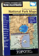
Trails Illustrated
is a very complete series of interactive maps by the National
Geographic. There are CDs for about each American State
and other CDs for specifical topics, as the one shown
here about National Parks. This one includes maps for
Yosemite, Denali, Hawaii Volcanoes, Yellowstone, Shenandoah,
Rocky Mountain, Mount Rainier, Arches, Grand Canyon, Zion,
Glacier, Great Smoky, Olympic, Grand Teton e Acadia. This
software is very well done and includes many famous trails
and gives the chance to draw your own ones. The only lack
I found refers to the impossibility of tracing the classic
famous trails automatically. If you want information about
them (as their profile, lenght...) you must first trace
them...with all the following disadvantages (try to trace
the Angels Landing Trail with all the many bends and making
your mouse passing exactly by the few meters wide trail's
last part...). Anyway, a good software and a good alternative
to the most precise and expensive DeLorme Topo 4.0.
|
| TrailSmart:
15 Major National Parks |
| by:
National Geographic |
| Price:
29.99 $ |
| Official
Site |
|
| |
|
| |
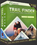
Trail Finder
was something new for me. This software works basically
with a web access. When you buy the software, you get
a web access to more than 30.000 trails' descriptions
taken from about 1.000 of the most famous outdoor books.
You can simply imagine to have full access to a huge library
right from your computer. Read properly the subscription
overview
since some features are not included in the software price
and are to be paid as extras. This is surely a very original
product, I tried a demo version in a store and I was extremely
impressed of it.
|
| Trail
Finder |
| by:
Trails.com |
| Price:
29.95$ |
| Official
Site |
| |
| |
|
| |
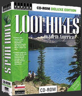
1,001 Hikes in North
America is another good software
for who's looking for some hiking experience in the USA.
This software comes on 1 CD and icludes basically a library
of the most famous hikes. Each one is analize in detail
with all the information concernig lenght, elevation gain,
difficulty,...with nice maps and photos. More, some expert
commentates the hike giving interesting information and
tips. Anyway don't expect a software like DeLorme Topo
4.0. 1001 Hikes gives you information JUST on the hikes
in its library. The map can't be zoomed, which means that
from the State map you can only go directly to the hike
map.
|
| 1,001
Hikes in North America |
| by:
Topics Entertainment |
| Price:
29.99$ |
| Official
Site |
| |
| |
|
|
|
The Road Atlas
is a software that I haven't tried yet. Below there is
the software's description that you find on the official
site.
Fast. Accurate. Innovative. Easy to
use.Rand McNally Road Atlas Travel Software puts America's
best-selling road atlas right on your desktop so you can
get maps and directions with no need to connect to the
Internet!
-
Quick
to install
-
Runs on the desktop – no need to re-insert the
CD once it's installed
-
Innovative three-window screen gives you easy access
searching, mapping, and directions
-
Simple search by name, address, or proximity
-
Quick-click State Maps
-
Instantly retrieve maps and locations you've visited
before
-
Driving directions on major roads in the U.S., Canada,
and Mexico, and within 83 major cities
-
Personalize your itineraries with directions, mileages,
and driving times
-
Print your trip maps!
-
Page and Grid™ references correspond to the printed
Rand McNally Road Atlas
-
Mobil Travel Guide® rated restaurants and hotels
|
|
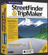
| |
| StreetFinder
& TripMaker |
| by:
Rand McNally |
| Price:
19.99$ |
| Official
Site |
|
StreetFinder & TripMaker,
is another software that I heven't tied yet. This is the
software's description copied and pasted from the official
site.
Rand McNally's award-winning StreetFinder®
and TripMaker® software is now available in this special
4-CD set, giving you everything you need to plan trips
and get accurate city routes right on your computer. Whether
you're headed downtown for a business meeting or vacationing
across the country, this collection includes extensive
mapping systems and exploration guides to make your journeys
quick and hassle-free. Rand McNally has provided accurate,
dependable, and user-friendly maps in the United States
for more than 130 years, so you can always rely on our
easy-to-follow, accurate information. Throw in customizable
maps, drawing tools, personalized itineraries, and more,
and you've got the most reliable source for planning trips
on your home PC. Whether you're a frequent business traveler,
family vacationer, or outdoor adventurer, this software
has what you need to create and enhance the perfect itineraries
for your kind of travel. Choose quick or scenic routes,
track with GPS (with compatible GPS receiver), plan end
of day stops, search street-level detail for major cities
… the possibilities are practically endless.
StreetFinder®
Features:
-
Address-to-address
directions
-
More than one
million business listings
-
Custom drawing
tools
-
Trip Organizer
to log daily schedules, reservations, and travel expenses
-
TripMaker®
Features:
-
Personalized itineraries
geared towards your interests and driving preferences
-
Customizable maps
with street-level detail
-
RoadSense feature
provides up-to-date road closure and traffic information
-
MoneyMinder tips
to help you budget and save while on the road
|
| |
|
|


)
)
)
)
)
)
)
)